Flossenbürg-Freiberg
From Holocaustmap
Names
Type
Dates
(YYYY-MM-DD)
- Opened:
- Closed:
List of (known) subcamps, internal and external work details
Internal work details (Kommando)
External work details (Aussenkommando)
- Außenkommando ”Hildebrand”[4][5]
- "unmittelbar neben den Schachtanlagen des Davidschachts an der Himmelfahrtsgasse"
Subcamps (Aussenlager)
Locations
Camp location

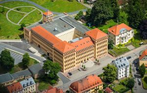
Factory Building
geo:50.913093,13.354831 (link for navigation systems)
- Street Address: Frauensteiner Straße 43
- District: Hüttenviertel
- Town: Freiberg
- State: Sachsen
- Country: Germany
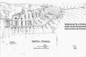
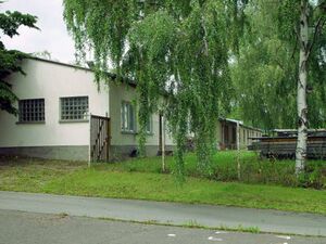
Barracks at Hammerberg (from December 1944)


- This location may not be accurate. More research is needed.
geo:50.91884,13.36590 (link for navigation systems)
- Street Address: Hammerberg
- District: [[]]
- Town: Freiberg
- State: Sachsen
- Country: Germany
Organisations involved
Victims and Survivors
Population information
Names of victims
Names of survivors
Location of graves
Staff
This camp was run by the SS-WVHA/Gestapo/Wehrmacht/DAF/OT
Names of perpetrators and any other people involved
Current status
Status of the site
Accessibility
Memorials
Factory Building
geo:50.912959/13.354649 (link for navigation systems)
- Street Address: Frauensteiner Straße 43
- District: Hüttenviertel
- Town: Freiberg
- State: Sachsen
- Country: Germany
No memorial known at this time.
Description
Outstanding questions
Resources
Bibliography
- United States Holocaust Memorial Museum Encyclopedia I-A page 595
- Das Nationalsozialistische Lagersystem, (CCP), page 236, 561, 638
- Verzeichnis der Haftstätten unter dem Reichsführer-SS 1933-1945, page 104
- Frauen in den Aussenlagern des KZ Flossenbürg (Hans Brenner, Regensburg, 1999)
- Die vergessenen Frauen von Mauthausen: Die weiblichen Häftlinge des Konzentrationslagers Mauthausen und ihre Geschichte (Vienna, 1997)
- Jüdisches Leben in der Bergstadt Freiberg—eine Spurensuche (Freiberg, n.d.)
- https://monami.hs-mittweida.de/frontdoor/deliver/index/docId/3786/file/Bachelorarbeit4.pdf
Links
- https://www.gedenkstaette-flossenbuerg.de/de/geschichte/aussenlager/freiberg
- https://www.gedenkplaetze.info/konzentrationslager/kz-flossenbuerg-aussenlager-freiberg
- https://www.oorlogsbronnen.nl/thema/Freiberg
- https://www.landkreis-mittelsachsen.de/das-amt/kontakt/werner-hofmann-haus.html
- http://lernen-aus-der-geschichte.de/sites/default/files/attach/projekt/antirassismus-projekt-fur-arbeitslose-jugendliche/c004t01d.pdf
Custodians
Sources
- ↑ United States Holocaust Memorial Museum Encyclopedia I-A page 595
- ↑ Verzeichnis der Haftstätten unter dem Reichsführer-SS 1933-1945, page 104
- ↑ Das Nationalsozialistische Lagersystem, (CCP), page 236, 561, 638
- ↑ http://lernen-aus-der-geschichte.de/sites/default/files/attach/projekt/antirassismus-projekt-fur-arbeitslose-jugendliche/c004t01d.pdf
- ↑ https://weiterdenken.de/de/2014/05/01/ortsbegehung-freiberg-hintergruende
- ↑ https://www.gedenkplaetze.info/konzentrationslager/kz-flossenbuerg-aussenlager-freiberg
- ↑ https://www.gedenkplaetze.info/konzentrationslager/kz-flossenbuerg-aussenlager-freiberg