File:Ganacker Fliegerhorst aerial.png
From Holocaustmap
Size of this preview: 715 × 600 pixels. Other resolution: 851 × 714 pixels.
Original file (851 × 714 pixels, file size: 694 KB, MIME type: image/png)
Summary
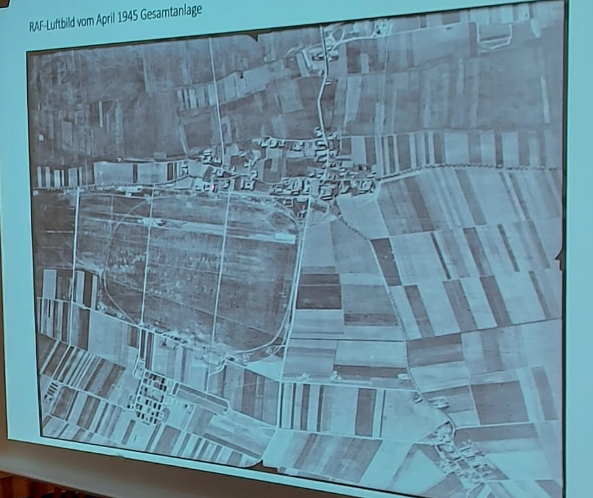
RAF Aerial photo of Fliegerhorst Ganacker, location of the forced labour camp Ganacker, subcamp of Flossenbürg
File history
Click on a date/time to view the file as it appeared at that time.
| Date/Time | Thumbnail | Dimensions | User | Comment | |
|---|---|---|---|---|---|
| current | 07:57, 21 December 2024 | | 851 × 714 (694 KB) | Davi (talk | contribs) | RAF Aerial photo of Fliegerhorst Ganacker, location of the forced labour camp Ganacker, subcamp of Flossenbürg |
You cannot overwrite this file.
File usage
The following page uses this file:
