File:Dachau Trostberg Lage-kz-aussenlager-trostberg.de.jpg
From Holocaustmap
Size of this preview: 800 × 478 pixels. Other resolution: 1,000 × 597 pixels.
Original file (1,000 × 597 pixels, file size: 216 KB, MIME type: image/jpeg)
Summary
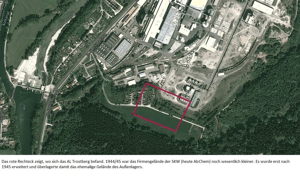
Satellite view of the current place where the Dachau-Trostberg subcamp used to be. Today AlzChem.
File history
Click on a date/time to view the file as it appeared at that time.
| Date/Time | Thumbnail | Dimensions | User | Comment | |
|---|---|---|---|---|---|
| current | 09:42, 12 May 2024 | | 1,000 × 597 (216 KB) | Davi (talk | contribs) | Satellite view of the current place where the Dachau-Trostberg subcamp used to be. Today AlzChem. |
You cannot overwrite this file.
File usage
The following page uses this file:
