Mauthausen-Wiener Neustadt: Difference between revisions
From Holocaustmap
mNo edit summary |
|||
| Line 18: | Line 18: | ||
* Closed: | * Closed: | ||
== | == Locations == | ||
<!-- Add the location here using openstreetmap (because accuracy is higher). To find the correct GPS coordinates, right-click on openstreetmap and click "Show Address", then copy from the address bar the two coordinates, separated by a / (example: from https://www.openstreetmap.org/search?whereami=1&query=51.208%2C12.239#map=7/51.210/12.239 , we take the 51.210/12.239 without the / before), then paste these two coordinates twice in the line below, replacing the two GPS placeholders. | <!-- Add the location here using openstreetmap (because accuracy is higher). To find the correct GPS coordinates, right-click on openstreetmap and click "Show Address", then copy from the address bar the two coordinates, separated by a / (example: from https://www.openstreetmap.org/search?whereami=1&query=51.208%2C12.239#map=7/51.210/12.239 , we take the 51.210/12.239 without the / before), then paste these two coordinates twice in the line below, replacing the two GPS placeholders. | ||
Add the reference you used and paste it between the <ref> tags., for example: | Add the reference you used and paste it between the <ref> tags., for example: | ||
<ref>United States Holocaust Memorial Museum Encyclopedia I-A page xxx</ref> | <ref>United States Holocaust Memorial Museum Encyclopedia I-A page xxx</ref> | ||
<ref>Das Nazionalsozialistische Lagersystem, (CCP), page xxx</ref> --> | <ref>Das Nazionalsozialistische Lagersystem, (CCP), page xxx</ref> --> | ||
Camp | |||
=== Camp === | |||
[https://www.openstreetmap.org/#map=16/47.82975/16.25281 47.82975/16.25281]<ref>https://www.bda.gv.at/dam/jcr:f9cf741d-120d-493b-9693-e3e5043f1b99/Katalog%20NS-Opferorte_Stand%20J%C3%A4nner%202022_BF_1.pdf</ref> | |||
* Street Address: [[Volksbadgasse]] | * Street Address: [[Volksbadgasse]] | ||
* District: [[Porsche-Viertel]] | * District: [[Porsche-Viertel]] | ||
| Line 30: | Line 32: | ||
* Country: [[Österreich]] | * Country: [[Österreich]] | ||
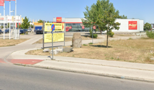
=== Guard bunker === | |||
[[File:Screenshot_2024-05-10_at_06-24-20_Mitterfeldgasse_·_2351_Wiener_Neudorf_Austria.png|thumb|Wachbunker for camp Wiener Neustadt, Stadionstrasse 40]] | [[File:Screenshot_2024-05-10_at_06-24-20_Mitterfeldgasse_·_2351_Wiener_Neudorf_Austria.png|thumb|Wachbunker for camp Wiener Neustadt, Stadionstrasse 40]] | ||
Guard Bunker: [https://www.openstreetmap.org/#map=16/47.82891/16.24788 | Guard Bunker: [https://www.openstreetmap.org/#map=16/47.82891/16.24788 | ||
Revision as of 04:37, 10 May 2024
Names
Type
List of (known) subcamps
Dates
- Opened:
- Closed:
Locations
Camp
- Street Address: Volksbadgasse
- District: Porsche-Viertel
- Town: Wiener Neustadt
- State: Niederösterreich
- Country: Österreich
Guard bunker

Guard Bunker: [https://www.openstreetmap.org/#map=16/47.82891/16.24788
- Street Address: Stadionstrasse near 40
- District: Porsche-Viertel
- Town: Wiener Neustadt
- State: Niederösterreich
- Country: Österreich
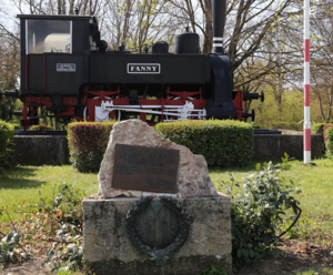
Memorials

Memorial: 47.82805/16.25530[5]
- Street Address: Pottendorfer Straße 51
- District: Porsche-Viertel
- Town: Wiener Neustadt
- State: Niederösterreich
- Country: Österreich
Memorial: 47.82588/16.25192[6][7]
Population
Company Names
[[]]
Victims and Survivors
Names of victims and survivors, if these are known.
Staff
This camp was run by the SS/Gestapo/Wehrmacht.
Names of SS and other people involved in the exploitation, including convictions where applicable.
Description
- ↑ United States Holocaust Memorial Museum Encyclopedia I-A page 956
- ↑ https://www.bda.gv.at/dam/jcr:f9cf741d-120d-493b-9693-e3e5043f1b99/Katalog%20NS-Opferorte_Stand%20J%C3%A4nner%202022_BF_1.pdf
- ↑ https://www.mauthausen-guides.at/en/node/78#main
- ↑ https://www.bda.gv.at/dam/jcr:f9cf741d-120d-493b-9693-e3e5043f1b99/Katalog%20NS-Opferorte_Stand%20J%C3%A4nner%202022_BF_1.pdf
- ↑ https://www.mauthausen-guides.at/en/node/78#main
- ↑ https://www.mauthausen-guides.at/en/node/78#main
- ↑ https://www.meinbezirk.at/wiener-neustadt/c-regionauten-community/wr-neustadt-2-teil-kk-pr-lokomotiv-und-maschinen-fabrik-1842-2021_a4596572#gallery=null